- Home
- :
- All Communities
- :
- Products
- :
- ArcGIS Data Interoperability
- :
- ArcGIS Data Interoperability Blog
- :
- Bruce Harold's Concave Hull Estimator Tool Enhance...
Bruce Harold's Concave Hull Estimator Tool Enhanced
- Subscribe to RSS Feed
- Mark as New
- Mark as Read
- Bookmark
- Subscribe
- Printer Friendly Page
- Report Inappropriate Content
Several discussions in the old forum referenced the Concave Hull Estimator script tool by esri's Bruce Harold, but during the conversion and website migrations all of the links to that tool were broken. I had made an enhanced version of the tool which I have attached. The bulk of the code is by Bruce, but the code that allows a user to select a case field was added by me. The case field creates selection sets of points for processing based on the case field values without having to manually create each set and run the tool separately for each.
An example output of the tool is shown below (I don't recall the k factor I used). All of the hulls were created using a case field number as shown.
Anyway, while the real credit for this tool belongs to Bruce, his original post has been referenced recently on several websites with each commenting that it the link has been lost. I wanted to revive the link to a version of that tool (with my own contribution thrown in). Interestingly, this tool included the use of a dictionary before I understood anything about what dictionaries did.
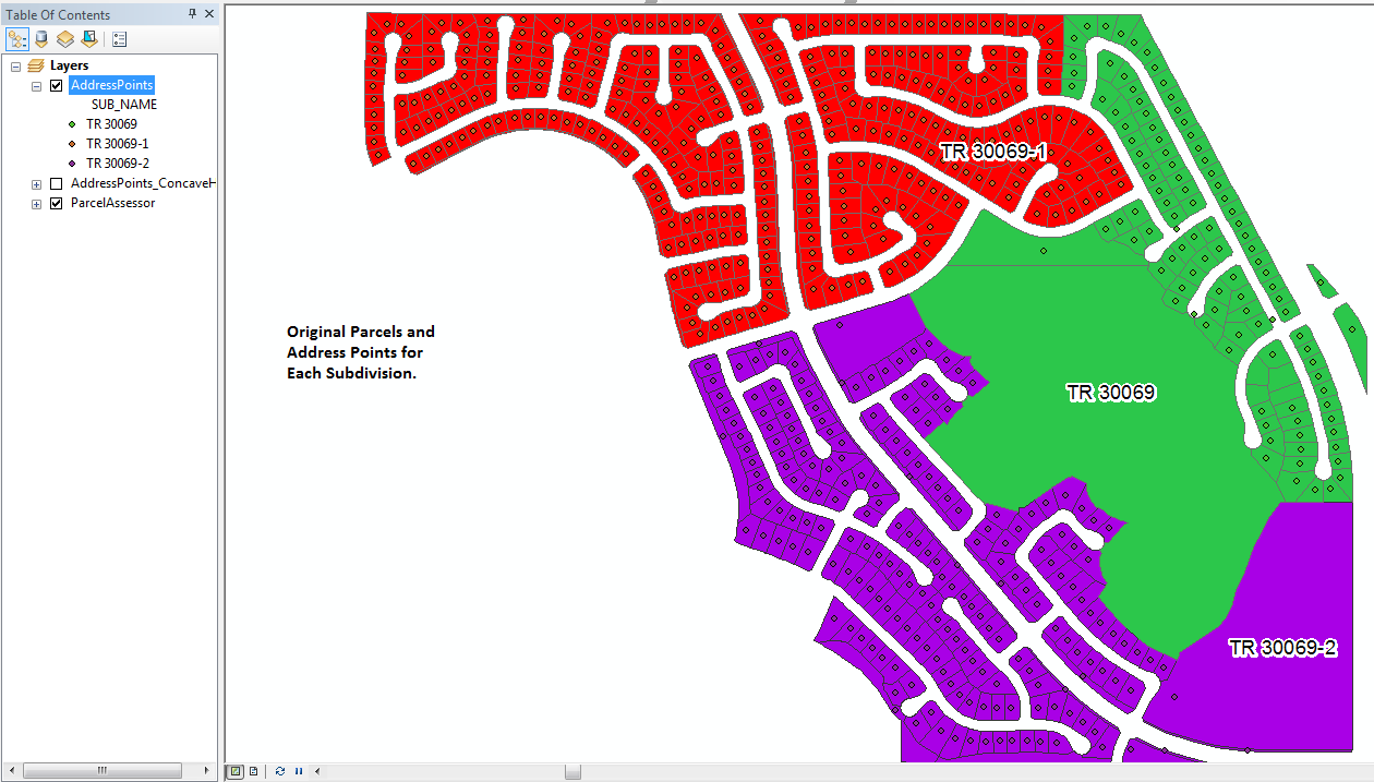
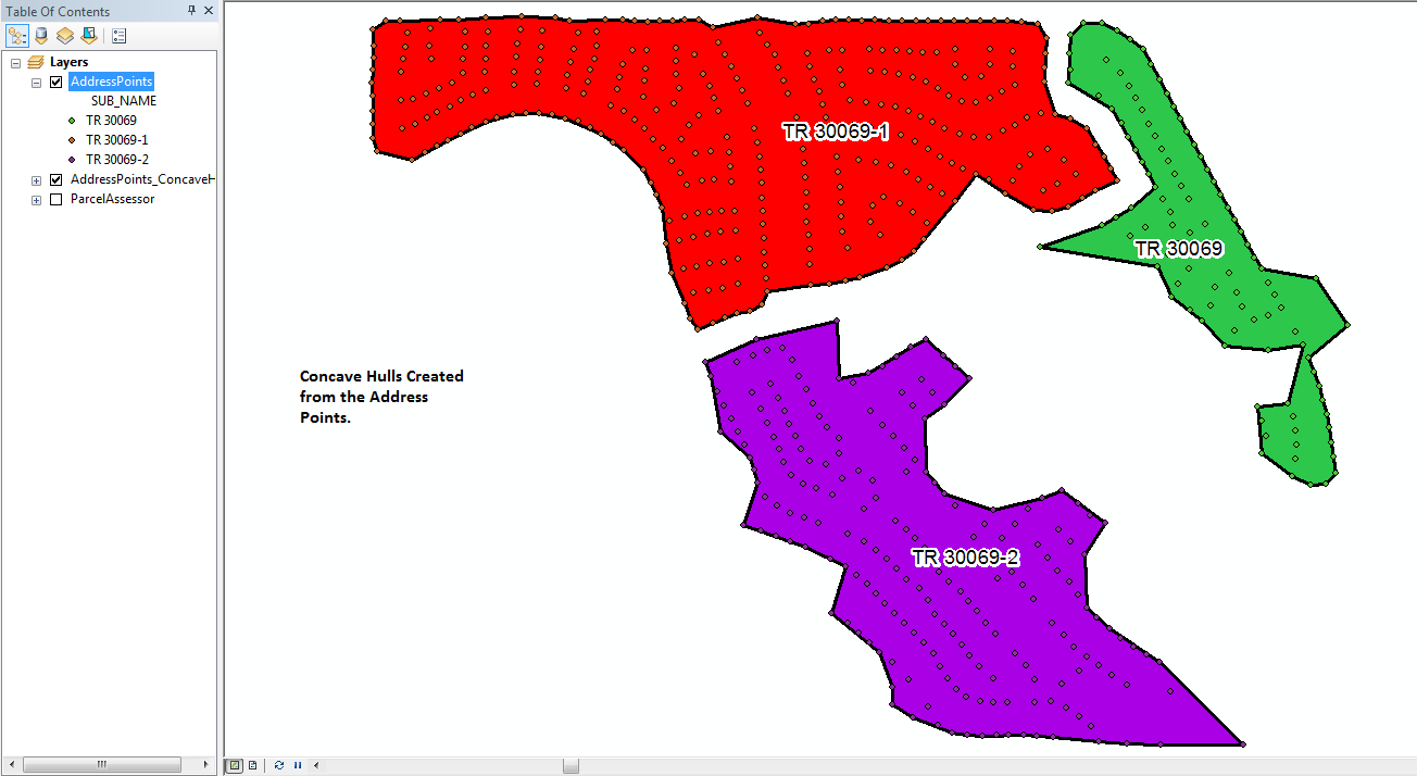
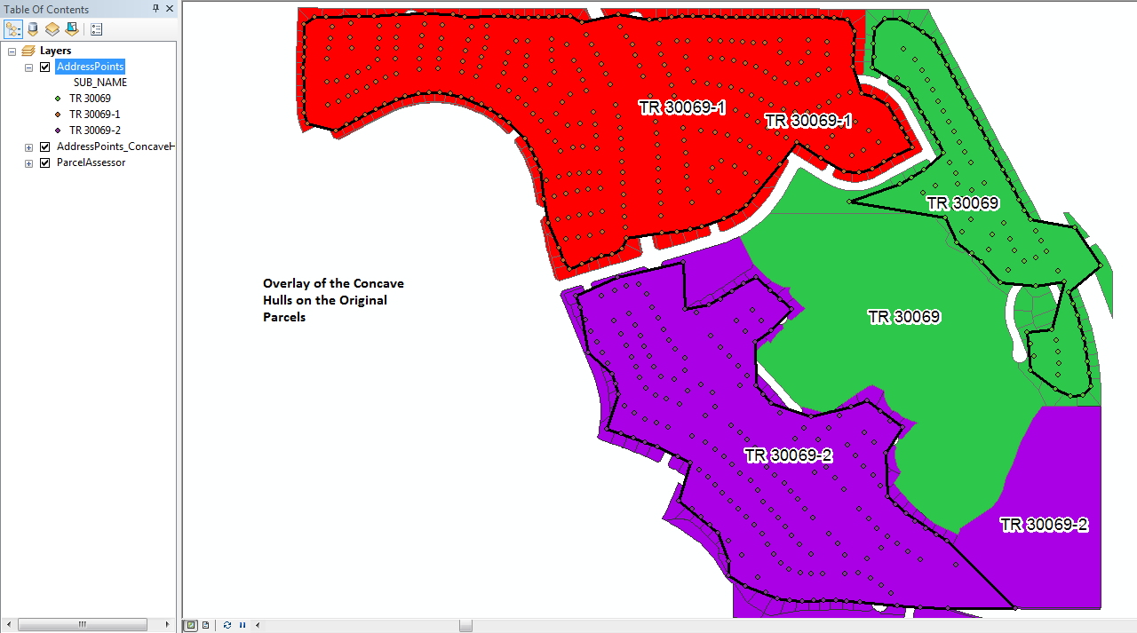
Here are pictures I just processed on a set of address points for three Subdivisions. For comparison the original parcels are shown. The starting k factor for this tool run was set to 3, but the tool iterated each point set to at least a k factor of 6 before creating each polygon (a k factor of 9 was used for one of them). The tool created the new hull feature class and all 3 hulls in under 35 seconds. The presence of somewhat regularly distributed points that fill the interior of the hull helps to create a more accurate hull outline than just using the set of points that ought to define the outline.


You must be a registered user to add a comment. If you've already registered, sign in. Otherwise, register and sign in.