Turn on suggestions
Auto-suggest helps you quickly narrow down your search results by suggesting possible matches as you type.
Cancel
A cave map with photo links in ArcGIS Online
Subscribe
848
3
05-03-2019 09:50 PM
- Subscribe to RSS Feed
- Mark as New
- Mark as Read
- Bookmark
- Subscribe
- Printer Friendly Page
- Report Inappropriate Content
05-03-2019
09:50 PM
This is an example of an online cave map with links to photos. The cave is real, it was mapped and (re-) discovered during a project for Humboldt-Toiyabe National Forest. The cave name is hidden, as is its location. Click the camera symbol to see the photos, you'll see it's a very unique and special cave.
The map was scanned and then published using ArcGIS Online to scale, It's geolinked, not geo-referenced, since that made the most sense for a cave of this size.
Click the camera icon to view the pop-up with a photo thumbnail. Click the thumbnail to view a larger photo.
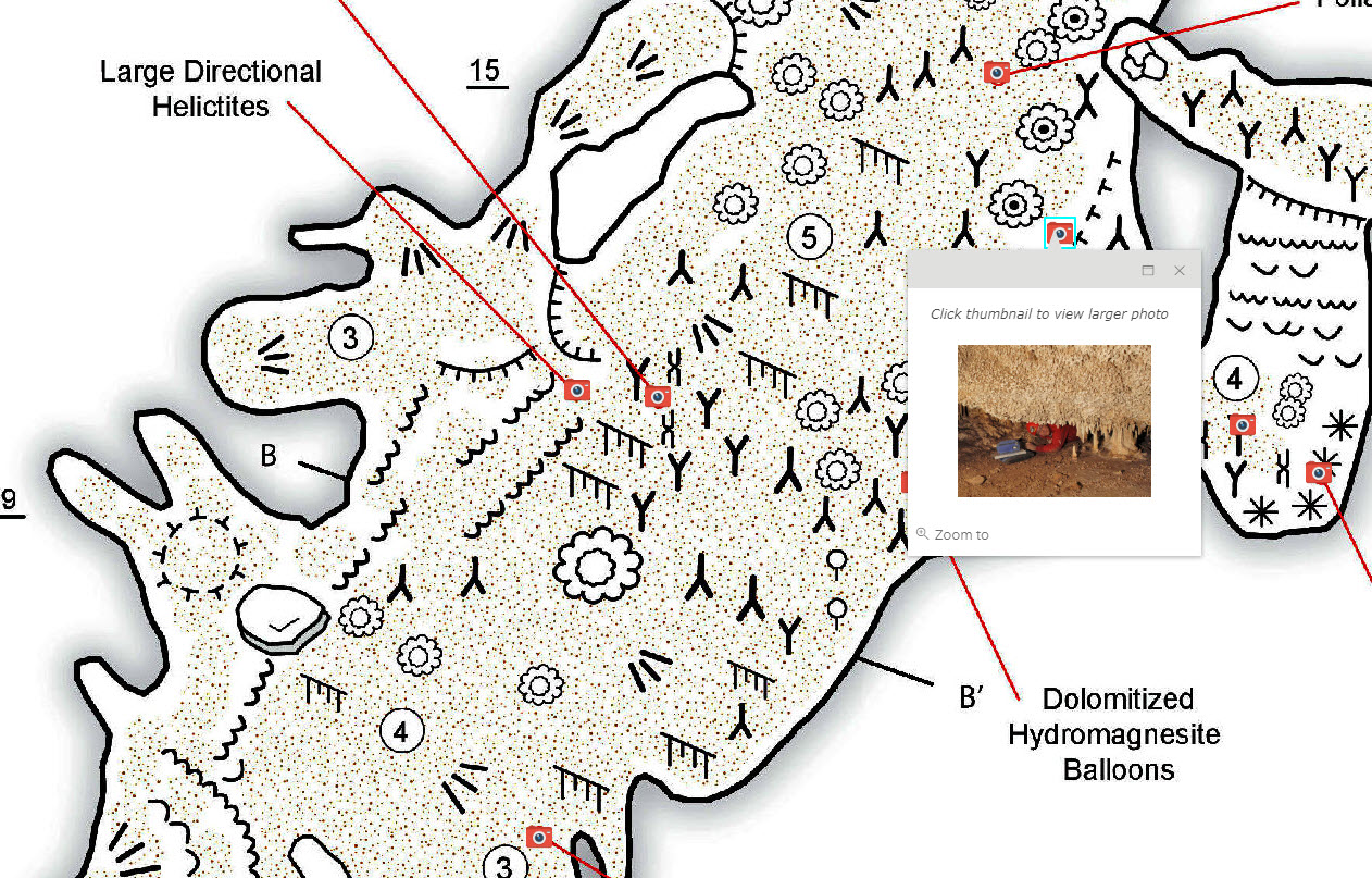
What I like about this example is that it uses the best tools for the best results. The cave map was drawn using Illustrator, and most cave maps are drawn using Illustrator or similar graphic programs. Yes, you could do this in ArcGIS Pro but it would be tedious. It's much easier to create this type of map in Illustrator, or Xara, or a similar graphics program. The map is actually geolinked (not georeferenced) to an ArcGIS Online feature layer in an online database. However it was published from ArcGIS Pro and used a technique to publish it at it's correct scale, so web map tools like Measure can be used.
Labels
3 Comments
You must be a registered user to add a comment. If you've already registered, sign in. Otherwise, register and sign in.
About the Author
Esri technical evangelist and product advocate. On a good day I'm making a map. On a great day I'm on one.
https://www.linkedin.com/in/bernszukalski/
bszukalski@esri.com
Labels